
Sasso: Views, Trails and History
Accommodation in Sasso
Sasso between rock, trails and remembrance
The Pieve di Santa Maria Assunta di Sasso stands on a rocky promontory overlooking the Val Termina di Castione. This church site combines a clearly defined landscape view with the trails that lead from here to the summit of Monte Fuso. La Rupe di Sasso is also a viewpoint in Neviano degli Arduini.
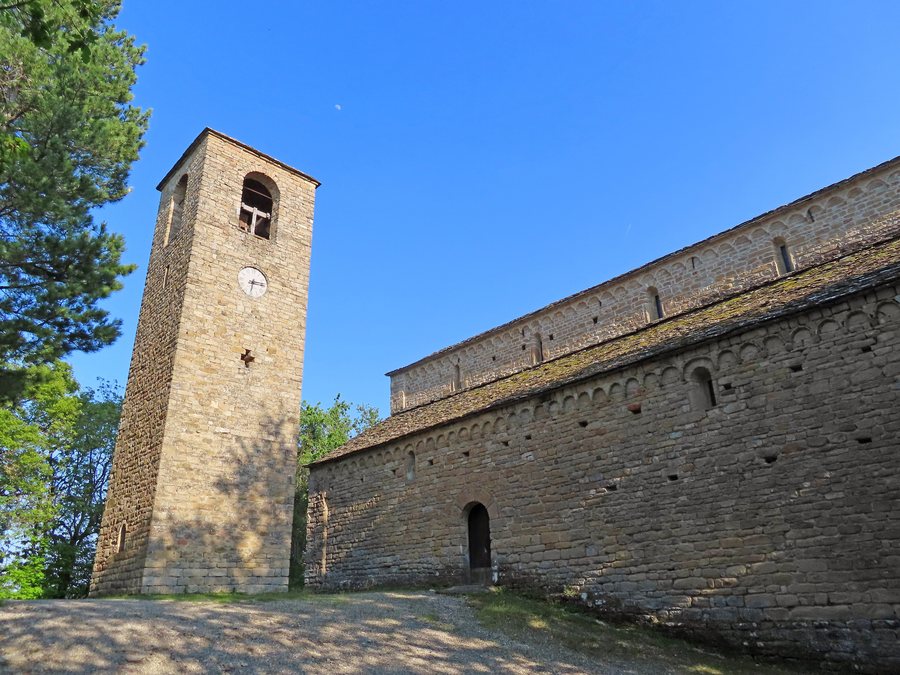 File:Pieve di Santa Maria Assunta (Sasso, Neviano degli Arduini) - campanile e lato nord 2022-05-10.jpg
Photo: Parma1983 via Source, CC BY-SA 4.0
File:Pieve di Santa Maria Assunta (Sasso, Neviano degli Arduini) - campanile e lato nord 2022-05-10.jpg
Photo: Parma1983 via Source, CC BY-SA 4.0
Hiking and cycling on Monte Fuso
Hiking and cycling routes lead from the Pieve di Sasso to the summit of Monte Fuso. The Via delle Pievi is recommended for covering the route on foot or by mountain bike. Its course passes through the municipalities of Traversetolo and Neviano degli Arduini and, over a 20-kilometre straight-line extent, touches the four parish churches of Traversetolo, Bazzano, Sasso and Scurano. The 20-kilometre straight-line extent thus defines the spatial framework connecting the four parish churches.
A particular focus is the Sentiero resistente. It consists of three sections that form a 20-kilometre circular route. The three sections structure the 20-kilometre loop; Rusino lies along the route between the Museo della Resistenza and the Centro faunistico. The trail connects the Museo della Resistenza with the Centro faunistico del Monte Fuso, passes through Rusino and returns to Sasso. At the same time, the Sentiero resistente is a multi-stage trail in the valleys of Monte Fuso in the Parma Apennines. There, it covers 11 sites of the war of liberation against the Nazi fascists, connects them with one another and tells their stories.
At each of these sites, you can download the GPX track of the trail by scanning a QR code and listen to selected audio features. Another connection, approximately 35 kilometres long, is the Sentiero di Arduino. It leads from the Pieve di Sasso in the municipality of Neviano degli Arduini to Castello di Canossa. At approximately 35 kilometres, the Sentiero di Arduino is longer than the 20-kilometre circular route of the Sentiero resistente.
The Resistance and local remembrance
The first core of today’s Museo Storico della Resistenza di Sasso was founded in 1973. The museum displays memorabilia and a series of videos documenting important moments of the partisan war in the mountains. Another specific place of remembrance lies on the route from the Museo della Resistenza di Sasso to the Centro Faunistico Monte Fuso: in the village of La Pietra, there is a memorial commemorating one of the victims of the raid on 1 July 1944.
Getting to the Pieve di Sasso
You can reach the Pieve di Santa Maria Assunta di Sasso via the Strada Provinciale 17 and the Strada Magrignano. Both roads therefore lead to the church site on the rocky promontory.
More destinations
Vicomero, Fontanelle, Pieveottoville, Sanguigna, Orzale, Bedonia, Neviano Degli Arduini
To the broader travel overview: Parma.
More about the destination
Useful information for planning your trip:

_-_campanile_e_lato_nord_2022-05-10.jpg)