
Cimolais: Dolomite Landscape, Trekking and Val Cimoliana
Accommodation in Cimolais
Cimolais is located in the Parco Naturale Dolomiti Friulane and combines a distinctive Dolomite landscape with trails through Val Cimoliana. The area offers opportunities for hiking, trekking and mountaineering. This gives the town a clear focus for travelers who want to combine nature experiences, mountain scenery and regional history.
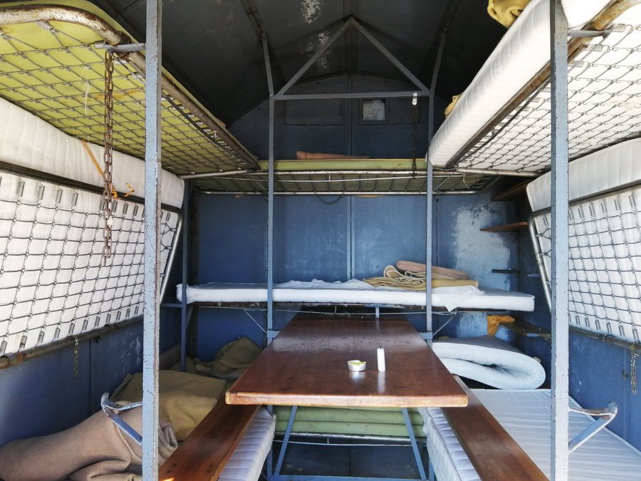 File:Inside view of Bivacco Greselin Paolo - Cimolais, Pordenone, Friuli-Venezia Giulia, Italy - 2022-10-02.jpg
Photo: Mænsard vokser via Source, CC BY-SA 4.0
File:Inside view of Bivacco Greselin Paolo - Cimolais, Pordenone, Friuli-Venezia Giulia, Italy - 2022-10-02.jpg
Photo: Mænsard vokser via Source, CC BY-SA 4.0
Dolomite Peak and Viewpoints
The defining natural feature is the Campanile di Val Montanaia. The 300-meter-high Dolomite peak lies in the upper Val Cimoliana and is one of the 19 geotopes of supranational interest in the Friuli Venezia Giulia region. The Sentiero dei Belvederi del Campanile di Val Montanaia leads to two viewpoints from which you can observe the Campanile di Val Montanaia. The route thus directs your attention specifically to a single, distinctive rock formation visible from far away.
Wildlife Park and Insights into the Past
Another side of the surrounding area is shown by the Parco Faunistico Pianpinedo in the locality of Piana di Pinedo between Cimolais and Claut. The fully enclosed wildlife park covers 35 hectares. Visitors can observe various examples of the local fauna there. The park also contains the Cason dei Boscaioli, which faithfully recreates the living conditions of forestry workers in the last century. Nature observation and a tangible insight into the former lives of forestry workers can be found at the same visitor destination.
Trails Along the Water and Old Mills
The Sentiero dei Mulini e Val Cimoliana follows a cycle path along the banks of the Cimoliana stream. It passes through the terraced meadows of Bresin, where several old stavoli have been restored. The trail also includes the remains of water-powered mills and sawmills, including a restored former sawmill. The route also leads to the Ponte di Lesca over a small gorge carved by the clear waters of the Cimoliana stream. In this way, the trail brings together landscape, water engineering and traces of rural life in one continuous setting.
Trekking Destinations in Val Cimoliana
The Trekking delle Bregoline starts in Pian Meluzzo and runs via Casera Roncada, Casera Bregolina Grande, Casera Bregolina Piccola and Casera Col d’Aniei. The Trekking da Cimolais a Forni di Sopra also starts in Pian Meluzzo. The starting point can be reached from Cimolais via the 13-kilometer road through Val Cimoliana, which includes both paved and unpaved sections.
Another destination is the Trekking forcella Duranno. It starts at Ponte Compol, which can be reached from Cimolais via the road through Val Cimoliana. It is particularly important for you to distinguish between the different starting points: Pian Meluzzo is the starting point for two trekking routes, while the Trekking forcella Duranno starts at Ponte Compol.
Practical Information
If you are traveling by motor vehicle on the road through Val Cimoliana, access is normally free of charge. However, a toll may be charged during certain periods. This restriction is part of planning the starting points, as is distinguishing between paved and unpaved sections of road.
Other destinations for regional orientation: Barcis, Tramonti di Sotto, Budoia, Vivaro, Pordenone, San Vito Al Tagliamento, Zoppola, Pasiano di Pordenone
To the higher-level travel overview: Pordenone.

