
Discover Mortegliano: History, Architecture and Landscape
Accommodation in Mortegliano
Mortegliano Between History and Landscape
Mortegliano combines local history, church architecture, regional character and a route through the landscape. The town is particularly interesting for you if you would like to include historical traces, religious buildings, regional terms and a longer tour in your travel plans.
Despite being largely destroyed, the Centa di Mortegliano can still be clearly identified. Traces of the Centa can be seen in the raised terrain beneath the present-day church, in several adjacent houses and in the road surrounding it. You therefore encounter the historic structure not just at a single location, but in several elements of the townscape today.
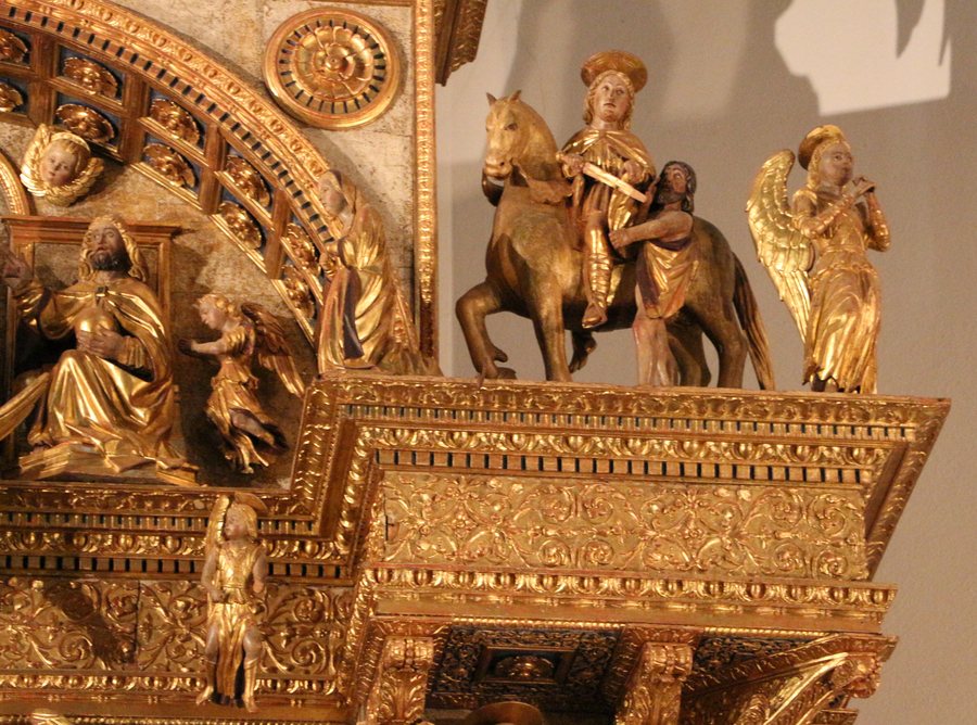 File:Giovanni martini da udine, pala di mortegliano, 1526, 05 san martino.jpg
Photo: Sailko via Wikimedia Commons, CC BY 3.0
File:Giovanni martini da udine, pala di mortegliano, 1526, 05 san martino.jpg
Photo: Sailko via Wikimedia Commons, CC BY 3.0
Traces of the Centa di Mortegliano
A Horse Race with Historical Significance
The Palio dei Turchi takes place every year at the Centa di Mortegliano. It is a horse race commemorating the victory of the inhabitants of Mortegliano over the Turks in 1499. If you would like to understand a place's cultural character through recurring traditions as well, this festival combines the memory of a historical event with an annual event.
Campanile and Duomo
The Campanile di Mortegliano is 113.2 metres high and has an octagonal floor plan. The Duomo di Mortegliano is a neo-Gothic church. Those interested in architectural forms and religious buildings will find different features here that can be clearly identified and taken into account when visiting the town.
Art, Language and Festivals
CASA CAVAZZINI – Museum of Modern and Contemporary Art is located in the vicinity of Mortegliano. This also allows cultural interest in Mortegliano to be extended to a museum in the surrounding area. Mortegliano is also associated with maize, which is called blave in Friulian.
The 82nd San Paolo patronal festival was celebrated in the Church of Santissima Trinità in Mortegliano. Alongside the Palio dei Turchi, this festival represents another event connected with Mortegliano.
The Route to Biotopo di Flambro
The Mortegliano–Biotopo di Flambro route is 49 kilometres long, has very little elevation gain and contains no technical sections. It starts in the centre of Mortegliano below the Campanile. Along the way, it crosses the Torrente Cormôr and runs through the landscape on unpaved paths. For planning your day, the route length is a separate factor in addition to the profile. The minimal elevation gain and lack of technical sections describe the demands of the route, while the unpaved paths determine the surface. The start in the centre below the Campanile and the crossing of the Torrente Cormôr mark two specific points along the route. This allows you to consciously consider distance, elevation gain, technical sections and trail surface separately when planning your day. If you are planning a longer cycling tour, these characteristics allow you to assess specifically whether a route with minimal elevation gain, no technical sections and unpaved paths suits your preferences.
You can also discover Cassacco, Sauris, Sella Nevea, Villa Vicentina, Percoto, Ravascletto, Torsa and Cividale Del Friuli for further travel planning.
For the overview of the wider region: Udine.

