
Usseaux amid mountain trails, murals and local traditions
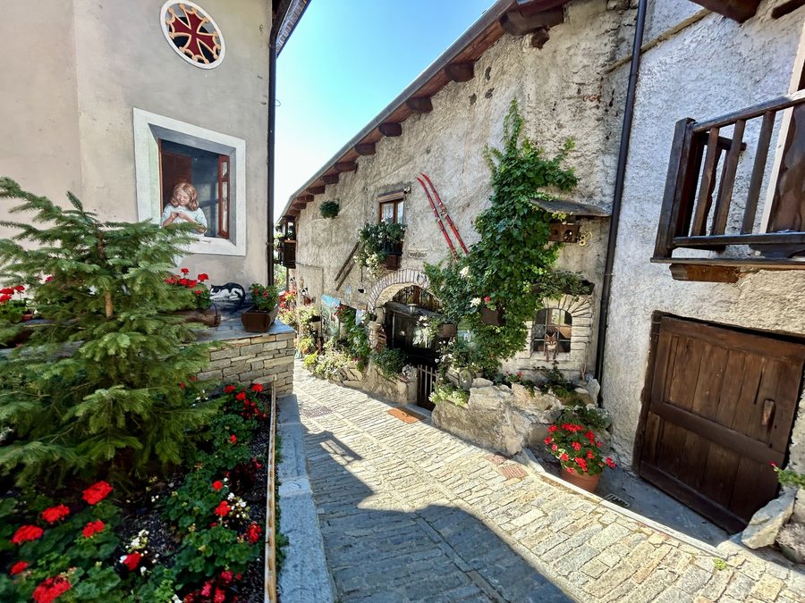 File:Usseaux - Comune di Usseaux - (2025-09-17) (1).jpeg
Photo: Olgierd Rudak via Wikimedia Commons, CC BY-SA 4.0
File:Usseaux - Comune di Usseaux - (2025-09-17) (1).jpeg
Photo: Olgierd Rudak via Wikimedia Commons, CC BY-SA 4.0
Usseaux is one of the municipalities in the Orsiera Rocciavrè Nature Park. Numerous murals shape the character of the village, while trails lead to high-altitude landscapes and historic structures. In Usseaux, the trail landscapes range from open meadows and high-altitude pastures to forests, alpine lakes and striking mountain peaks.
Hiking trails between lakes, forests and pastures
The official route “Verso i pascoli di montagna d’Usseaux” leads through the village, characterised by numerous murals, to remote, high-altitude hamlets on open meadows with expansive views.
The official route “03 Laghi dell’Albergian” is a classic high-altitude hike to alpine lakes, summer flowers and striking mountain peaks. As a high-altitude hike, Route 03 has a different landscape focus from the forested circular hike. The official route “05 Sentieri Larici-Cembreta” is a circular hike through larch and Swiss stone pine forests, where animal tracks can also be found.
The official route “09 Balboutet: Alpe Assietta” runs through a green high valley with extensive high-altitude pastures, streams and impressive panoramic views. Another option is the official route “11 Pian dell’Alpe Pequerel – Il Forte Serre-Marie”. It is an easy circular hike through pastures and forests to military forts from the 18th and 19th centuries, as well as an avalanche protection structure. Montagne d’Usseaux, also known as Borgata Giurdan, lies on the long-distance Sentiero del Plaisentif hiking trail.
Practical orientation on one route
For the “Sentieri Larici-Cembreta” route, parking is available along the Strada Comunale dell’Inverso near the bridge over the Torrente Chisone. A bus stop on the SP23r is 150 metres from the route’s starting point. This means that parking on the Strada Comunale dell’Inverso and a bus stop on the SP23r serve as clear reference points for starting this route.
Murals, a church and historic structures
Usseaux is known for its numerous murals. The parish church of Usseaux dates from the 17th century. The Mulino Canton is well preserved and still in working order.
The Strada dell’Assietta is an ancient military road from the 18th century. It runs at an altitude of over 2,000 metres along a route approximately 40 kilometres long and connects the municipality of Usseaux with Sestriere and Alta Val Susa. The approximately 40-kilometre distance and the altitude of over 2,000 metres should be taken into account when planning this historic military road. Forte del Colle delle Finestre dates from 1891.
Local specialities made from bread and cheese
The local bread Pan fournià is baked for at least one hour in a wood-fired oven after the dough has been left to rise for a long time.
The cheese Plaisentif – formaggio delle viole – takes centre stage on the long-distance Sentiero del Plaisentif hiking trail. Tastings of this cheese are offered in Usseaux; Plaisentif is also served with local bread.
Further places to compare
Romano Canavese, Agliè, Riva presso Chieri, Carmagnola, Trofarello, Casalborgone, Sparone and Villar Focchiardo
To the overarching travel overview: Turin.
Check prices, availability and amenities for your travel dates directly on Booking.com.
View accommodation and offersAdvertisement · Partner link to Booking.com
_(1).jpeg)