
Loiri Porto San Paolo: Coast, Islands and Sardinian Culture
Accommodation in Loiri Porto San Paolo
Between the Hilly Hinterland and the Tavolara Marine Protected Area
Loiri Porto San Paolo combines a hilly hinterland with characteristic stazzi and a coastline facing the Tavolara Marine Protected Area. This connection shapes how the area can be approached: you can view the coast and the Sardinian hinterland as different sides of the same destination.
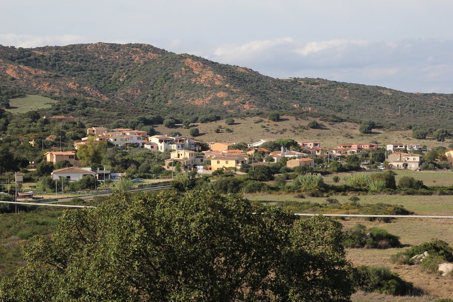 File:Loiri-Porto San Paolo, frazione Vaccileddi (02).jpg
Photo: Gianni Careddu via Wikimedia Commons, CC BY-SA 4.0
File:Loiri-Porto San Paolo, frazione Vaccileddi (02).jpg
Photo: Gianni Careddu via Wikimedia Commons, CC BY-SA 4.0
The Area Marina Protetta di Tavolara marine protected area covers 15,091 hectares of sea and approximately 40 km of coastline. The municipality of Loiri Porto San Paolo includes seven beaches. The coastal perspective also includes the “Bibliospiaggia”, an open-air library. The figure of seven beaches applies to the municipal area, while the approximately 40 km of coastline applies to the marine protected area.
Island Connections and Coastal Paths
Daily connections run from Porto San Paolo to Tavolara and to the smaller islands of Molara, Molarotto, Piana and dei Cavalli. These places provide a maritime focus for your planning, while Loiri Porto San Paolo is also shaped by its hilly surroundings.
An unpaved path approximately 3 km long leads from Porto San Paolo to Spiaggia Corallina and then continues close to the coast through the Mediterranean maquis typical of Gallura towards Spiaggia di Porto Istana. The route connects several specific coastal points with a landscape whose character is made visible by the maquis. For this coastal stretch, both the approximate length and the unpaved surface are equally relevant to practical day planning in the area.
Hiking with Gallurese Storytelling Tradition
The “Lu Caminu Di Li falchi” trail extends for 11 km between Porto San Paolo, Tiriddò and La Castagna. The entire route is estimated to require approximately 4 hours and 30 minutes of walking. Its name, “Sentiero dei Falchi” in Italian, is connected with the Gallurese tradition of stories told around the fire, the “li conti di lu fuchili”. The paths differ in length: the coastal path is approximately 3 km long, while “Lu Caminu Di Li falchi” extends for 11 km.
At an altitude of approximately 500 metres on Monte Loiri, ruins from the Nuragic period are still visible.
Churches and Cultural Life
The parish church of San Nicola di Bari is located at Piazza San Nicola di Bari 1 in Loiri, 07020. It is a 20th-century granite building. The rural church of Santa Giusta and San Biagio dates from the late Middle Ages and has a small cemetery.
Casa Enas is intended as an inclusive cultural venue for the local community and the surrounding area. Its planned programme includes cultural, theatre and circus arts events, concerts, courses and workshops, exhibitions, festivals, craft markets and art therapy activities. This provides a broad range of options for your travel planning, spanning landscapes, history and contemporary culture.
Other Destinations in the Surrounding Area
Monti, Berchiddeddu, Ottiolu, Aglientu, Costa Serena, Portisco, Golfo Aranci, Suaredda-traversa
To the higher-level travel overview: Olbia-Tempio.

.jpg)