
Discover Mascioni on Lake Campotosto
Accommodation in Mascioni
Mascioni lies on a small hill on the shore of Lake Campotosto, within the Gran Sasso e Monti della Laga National Park. The lake shore and the park therefore help situate the village geographically. A stage of the Cammino nelle Terre Mutate runs from Campotosto to Mascioni. If you are looking for a combination of village scenery, landscape and hiking, you can consider these three perspectives together.
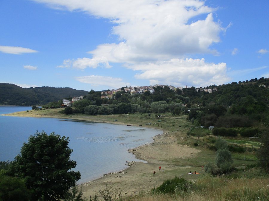
Landscape and village scenery
Paved lanes and stone houses shape the village. The houses are built in the typical architectural style of Abruzzo and blend into the surrounding landscape. Interest in Mascioni therefore extends beyond the lake and its location in the national park to include regional architecture. If you enjoy taking in village scenery, the interplay of lanes, stone houses and landscape offers a specific point of interest.
A local historical connection
One specific historical connection is Blessed Andrea da Montereale, who was born in Mascioni in 1403. A chapel dedicated to him stands near his birthplace. The birthplace and chapel connect a person known by name with the village, adding a specific cultural point of interest to its natural setting.
Hiking the Cammino nelle Terre Mutate
The Cammino nelle Terre Mutate includes a 14-kilometre stage from Campotosto to Mascioni, taking about five hours. This approximate duration gives you an idea for planning, but is not an exact schedule. On this stage, the trail climbs to the summit plateau of Monte Mascioni, from where the panoramic view reaches the Gran Sasso massif. The route thus connects the two villages with a climb into the mountain landscape. Check trail conditions locally before setting out.
Three trails around Lake Campotosto pass by the lake. These include the Campotosto–Mascioni and Mascioni–Collebrincioni stages of the Cammino nelle Terre Mutate. This overview complements information about the individual stage with a look at the trail network around the lake.
Getting your bearings and other activities
The Carta dei Sentieri del Lago di Campotosto project ran in 2021–2022. It included a hiking map distributed free of charge in the area and improvements to a large part of the trail network. The map contains brief descriptions of some trails, as well as useful information in Italian and English about accommodation, transport and health services. Check current details about individual services and trail conditions before relying on them or setting out on a hike.
Canoeing is permitted on Lake Campotosto, but the municipality does not currently organise this activity. Permission to canoe on the lake does not therefore mean that the municipality offers organised canoeing. Another regional option is a 54-kilometre e-bike loop designated at Lake Campotosto. Hiking, canoeing and cycling are thus different topics to consider when planning, without implying that they are the same offering or require the same kind of stay.
Discover more destinations
Discover more destinations: Balsorano, Scanno, Cappadocia, Bisegna, Ortona dei Marsi, Collepietro, Capistrello, Cansano.
Return to the main travel overview: L-Aquila.

